

Master plan for northeast Riyadh unveiled, aims for integrated modern city
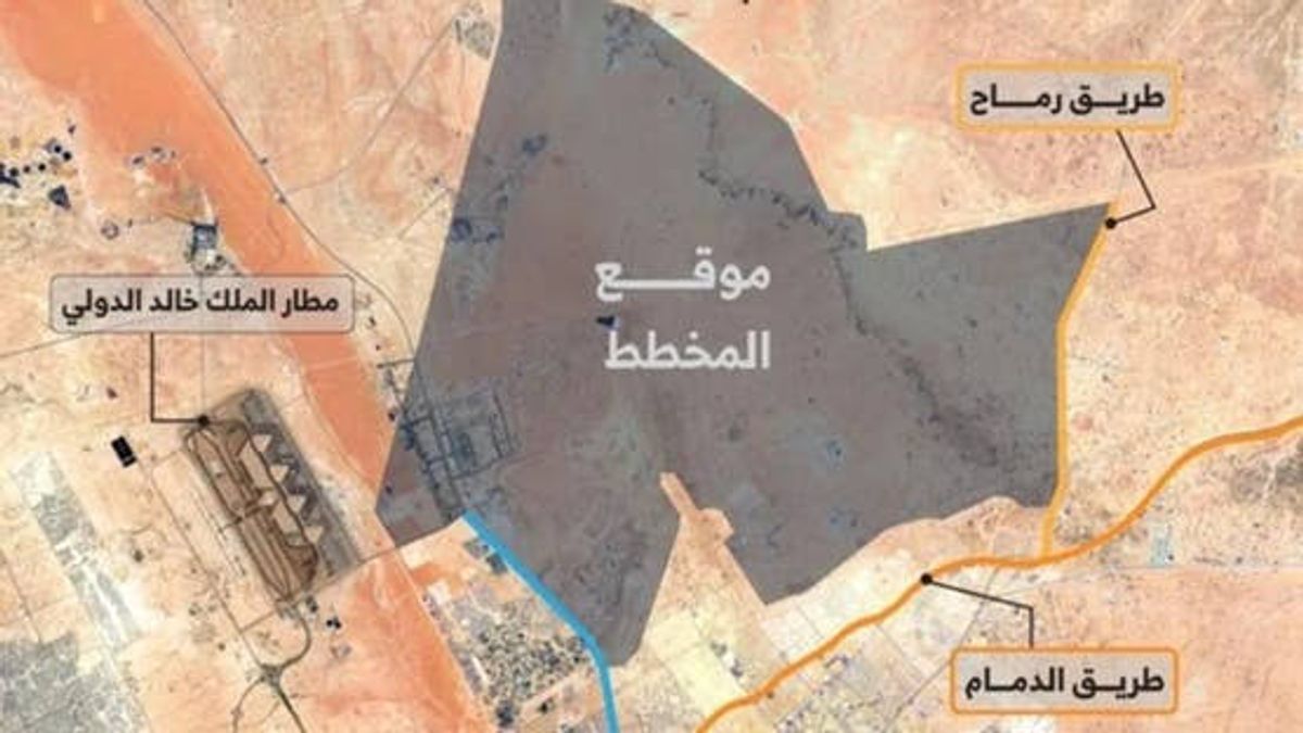
The Royal Commission for Riyadh City has completed the master plan for northeast Riyadh, covering a total area of approximately 456 square kilometers.
Key Takeaways
AI
The Royal Commission for Riyadh City has announced the completion of the master plan for northeast Riyadh, which spans a total area of about 456 square kilometers.
In comments to Al Ekhbariya TV, engineering consultant Saud Al-Dulbahi said the project embodies a fully integrated modern city with a strategic location and advanced infrastructure. He explained that the area represents a new city designed according to best practices, connected to King Khalid International Airport, Wadi Al-Sulay, and the Dammam and Janadriyah roads.
He added that the plan provides a comprehensive vision for land use in the area, based on several key principles. These include establishing a long-term urban model that allows for phased expansion, designing integrated communities that combine housing with daily services, and achieving a balanced distribution between residential, economic, recreational, and natural zones.
View the post on X
Al-Dulbahi noted that preparing the plan is part of Riyadh's long-term expansion strategy, as the capital continues to experience rapid urban, population, and economic growth.
He stressed that the plan will help organize one of the city's future growth directions to meet both current and future needs, with a focus on improving quality of life, increasing green spaces, and preserving natural valleys through balanced and interconnected planning.