
Madinah, one of the Arabian Peninsula's oldest and most significant geological formations, is situated in western Saudi Arabia within the Arabian Shield.
This vast rock mass, encompassing much of the peninsula's western part, dates back to the Precambrian period, over 540 million years ago.
Located at 24.28 degrees north latitude and 39.36 degrees east longitude, Madinah's average height above sea level is between 600 and 640 meters, leading to its natural encirclement by highlands on most sides, except to the northwest.
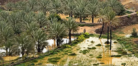
Despite its dry climate, Madinah has historically thrived as a green agricultural oasis.
This is due to its fertile soil, plentiful groundwater, and seasonal valleys. The region is well-known for its palm cultivation and diverse vegetation.
The surrounding geographical and geological features, including mountain formations and modern sediments, are crucial to this fertility, enriching the soil with essential natural elements.
Madinah is encircled by notable mountains, with Mount Uhud being the most prominent. Situated approximately 5.5 kilometers north of the Prophet's Mosque, this natural and historical symbol rises to about 1,077 meters above sea level and primarily comprises striking red Rhyolite igneous rocks.
West of the Prophet's Mosque, the Jamawat mountains feature medium-altitude terrain, reaching approximately 965 meters.
This area is characterized by granite and granodiorite, underground igneous formations from solidified lava.
Further west, Jummah Mountain stretches from Taibah University to Al-Salam neighborhood, reaching about 944 meters and primarily composed of granite.
Sela Mountain, located northwest of the Prophet's Mosque, is characterized by a solid base of hard, dark gray to black gabbro rock, reaching approximately 681 meters in height.
To the south of Madinah, Ayr Mountain stands as a notable volcanic feature, entirely encircled by basalt rocks except for its northwest side, indicating ancient volcanic activity.
Madinah boasts a rich variety of rock types, revealing diverse geological stages. Among them are basement rocks, ancient igneous formations from the Precambrian period, including acidic and basic types like rhyolite, dacite, and andesite.
These rocks are particularly visible in Madinah's northern and western areas, intermingled with other igneous rocks, underscoring the region's volcanic past.
Three massive volcanic lava flows (harrat) encircle Madinah. These significant geological features comprise dark basalt lava from late geological eras, which extends over vast areas around Madinah.
Alongside mountains and harrat, modern sediments form a significant geological feature, covering most of its land and creating a sedimentary basin with an average height above sea level of 625 meters.
These sediments are largely the result of erosion and weathering from surrounding mountainous heights, transported into Madinah's terrain by a network of seasonal valleys that carry significant quantities of soil and rock fragments during rainy seasons.
Among the most renowned valleys is Al-Aqeeq Valley, which traverses Madinah from south to north, converging with the Qanat Valley west of Mount Uhud.
It is considered one of the oldest and most historically significant valleys due to its fertility and contribution to nourishing agricultural lands, alongside several other historic valleys in the region.
