

Buraidah’s khubub reflect deep ties between people and land in Qassim
The khubub of Buraidah are a living memory of Qassim’s agricultural heritage, linking human settlement to the land before modern urban expansion.
Key Takeaways
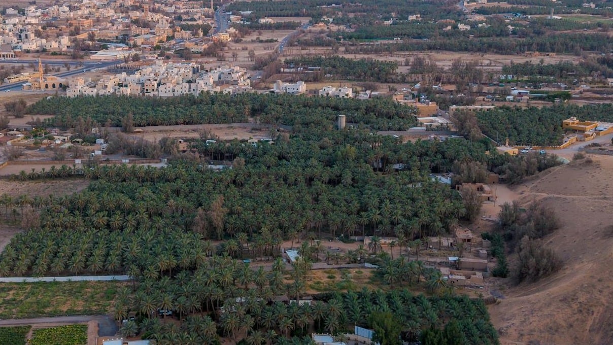
AIThe khubub of Buraidah are among the most prominent environmental and social landmarks in the Qassim region. Emerging between sand dunes, water sources, and farmlands, they have long embodied the enduring relationship between people and their land. Over generations, these low-lying areas were transformed into fertile environments suitable for agriculture and settlement, leading to the establishment of farms, wells, and homes. Communities grew around them before urban development altered many of their features, though their names remain as witnesses to the area's history and transformation.
The term “khubub” (plural of khabb) carries a geographical meaning tied to the nature of the land, locally referring to depressions between sand dunes. The unique characteristics and availability of water in these areas created favorable conditions for agriculture and habitation. Residents relied on wells, known locally as “qalban,” for drinking and irrigation. Palm trees dominated the agricultural landscape, alongside grains, vegetables, and fodder crops.
Settlement and economic activity
The presence of water and arable land in the khubub fostered stable communities, with homes built near farms and wells. Farms, wells, houses, and mosques became essential elements of daily life. The rhythm of life was closely linked to irrigation, planting, harvest seasons, and date picking. Neighborly relations and cooperation flourished, making the khubub centers of residence, work, and social life.
The khubub also played a vital role in the economic activity of Buraidah and its surroundings. Their agricultural products fueled trade and linked production areas to markets, reflecting the central role of farming in the city’s economic history.
The importance of preserving local memory
Dr. Suleiman Al-Atani, a history professor at Qassim University, emphasized that Buraidah’s khubub represent a significant part of the city’s historical, social, and economic memory. He noted that studying them goes beyond geography to explore the relationship between people, land, and water, and how resources were harnessed to establish stable, productive communities that contributed to the city’s growth and prosperity.
Al-Atani pointed out that the nature of the khubub helped collect rainwater and retain soil moisture, making them ideal for agriculture and settlement. He stressed that the palm tree was a key feature of agricultural life in the khubub, fostering inherited farming expertise and a lifestyle closely connected to land and water.
Urban transformation and heritage preservation
Saudi Arabia has witnessed advances in roads, services, and agricultural and irrigation methods, alongside urban expansion in Buraidah. This has led to the integration of several khubub into the urban fabric, with parts transformed into modern neighborhoods and facilities. Al-Atani underscored the importance of documenting the memory of the khubub—their names, boundaries, farms, wells, mosques, and roads—and preserving related stories, photographs, and documents as part of the city’s cultural and historical heritage.
Between the khubub of the past—where life revolved around wells, farms, and palm trees—and today’s sites absorbed by urban growth, the names continue to tell Buraidah’s story, preserving the memory of people’s connection to land and water and chronicling a chapter in Qassim’s agricultural, social, and urban transformation.