

Royal Commission completes master plan for northeast Riyadh
The Royal Commission for Riyadh City has finalized the preliminary master plan for northeast Riyadh, covering 456 sq km and focusing on balanced development.
Key Takeaways
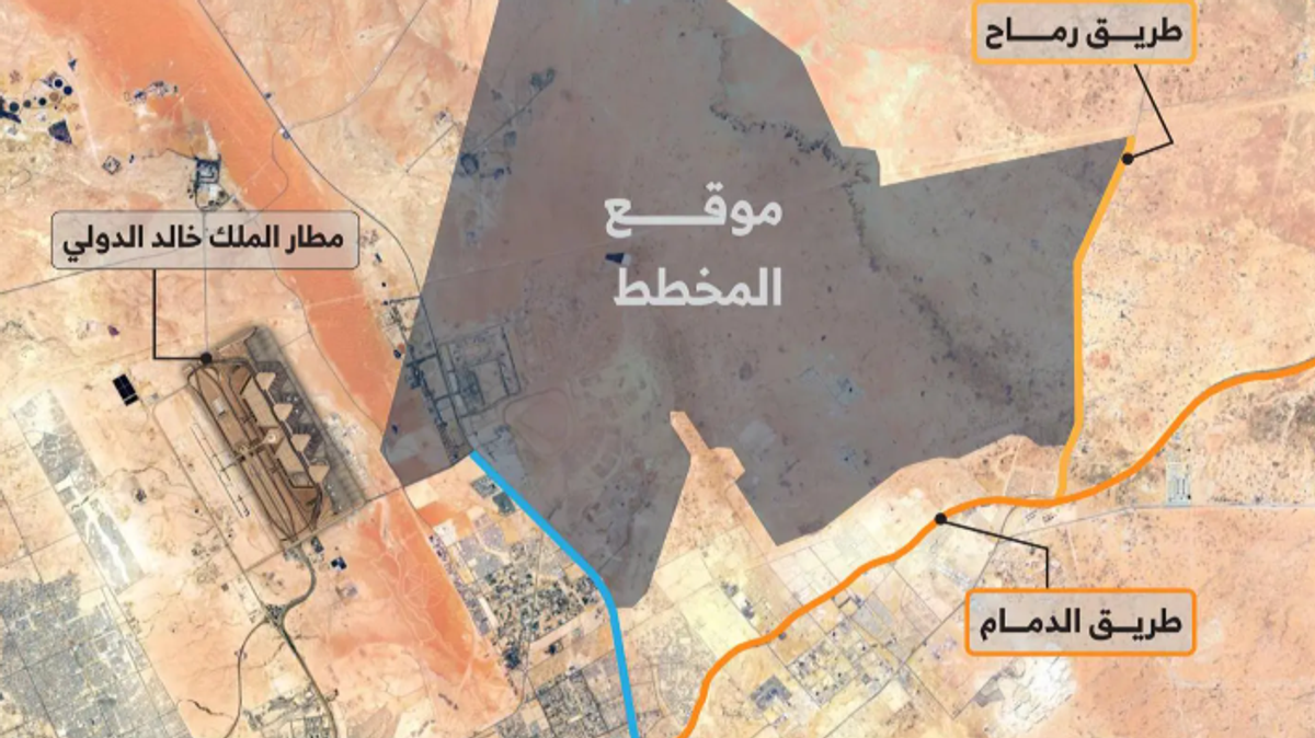
AIThe Royal Commission for Riyadh City has announced the completion of the preliminary master plan for the northeast area of the capital, covering approximately 456 square kilometers. The plan encompasses the eastern extension of Riyadh and is connected to major routes such as Dammam Road and Rumah Road. It is also adjacent to King Khalid International Airport, giving the area a strategic position within the city’s future development framework.
Saleh Al-Zuwaid, Director of Media and Communications at the Commission, explained that the plan was developed based on a comprehensive study of land use, road networks, and infrastructure, while taking environmental considerations into account to ensure balanced and integrated growth with other parts of the capital.
Al-Zuwaid noted that the team examined all key elements in the area, including road networks, land use, services, and urban facilities, to create a holistic vision that ensures balanced development for the region.
The plan is based on core principles, most notably the creation of a long-term urban model that allows for phased expansion, and the design of integrated communities that combine residential areas with daily services, ensuring a balanced distribution of residential, economic, recreational, and natural zones.
The master plan aims to prepare for Riyadh’s next phases of growth, providing a clear planning framework for detailed designs by relevant authorities, with a focus on improving quality of life, expanding green spaces, and preserving natural valleys within a cohesive and balanced layout.